Part 1: Inroduction to CNG key concepts
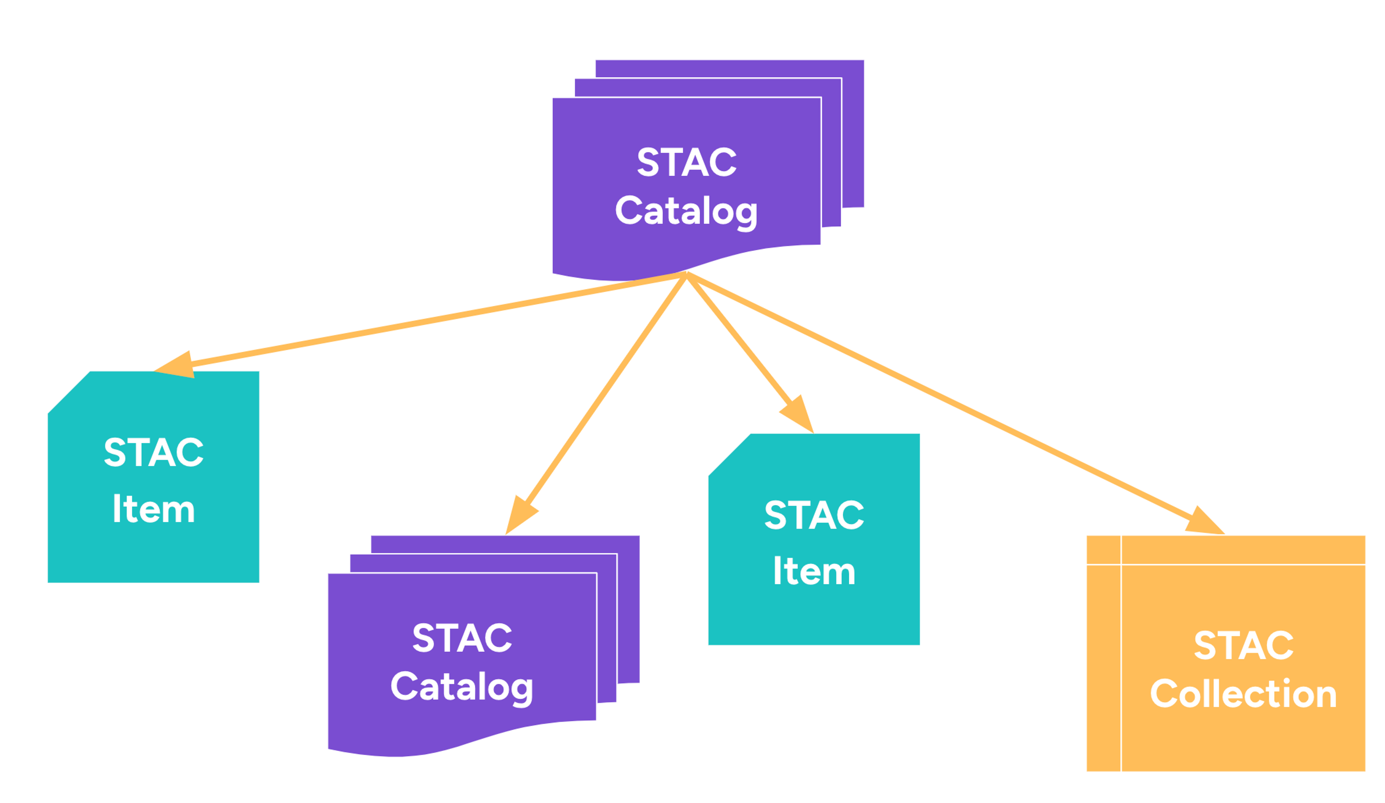
Part 2: Data discovery and STAC in Action
With thriveGEO’s ‘Cloud-Native Geospatial 101’ course you learn the skills needed to process large volumes of geospatial data in the cloud.
Spend less time downloading massive amounts of data and more time deriving data-driven insights.
Next course dates: Autumn 2025
Acquire high in-demand data and cloud skills that set you up for your next career move.
Our courses stand out through their interactive and hands-on format.
Receive an official certification from the Cloud-Native Geospatial Forum after successful completion.
This course introduces you to cloud-native geospatial, a new set of standards to work with geospatial data in the cloud. The course consists of four fundamental modules, in which you practically work with key parts of the cloud-native geospatial technology stack, including STAC, cloud-optimized geospatial data formats (COG, Zarr, Geoparquet) and xarray + Dask.

Part 1: Inroduction to CNG key concepts
Part 2: Data discovery and STAC in Action

Part 1: Cloud-Optimized Formats for Raster data
Part 2: Cloud-Optimized Formats for Vector data

Learn how to parallelise and scale your workflows with xarray and Dask.

During the capstone project, you apply the skills you acquired and you work on your first cloud-native geospatial project.
Express your interest for the next cohort in autumn 2025. This cohort will run in a part-time format. Over the course of two weeks, you will have a mix of lectures & tutorial sessions, office hours and self-paced take-home assignments. Expected time investment of 10-12 hours per week.
We offer two course times to accomodate different time zones.
Update: new course dates will be announced soon.
Week 1
Week 2
Office hours are optional.
Week 1
Week 2
Week 2
Update: new course dates will be announced soon.
Week 1
Week 2
Office hours are optional.
Week 1
Week 2
Week 2
Julia and Sabrina have a real gift for explaining technical concepts in an accessible and engaging way. I especially appreciated the workshop's balance between theoretical teachings and practical applications within a organized, friendly, and supportive environment.
Being able to apply what we learned in a final mini project was such a rewarding and meaningful experience - I converted a personal Jupyter notebook from using a NetCDF file to a Zarr file, which significantly reduced both processing time and file size.
I left the workshop feeling more confident and excited about where to dive deeper and continue my cloud-native geospatial journey. I’d absolutely recommend this to anyone curious about advancing their geospatial skills for the future of geospatial.
I liked that we had full code scripts to run through while we were learning so we had clear things to reference when we were building our own mini project at the end.
Our courses set a new standard for Earth Observation and geospatial data training:
Through partnerships with leading data and technology organisations, we ensure that our courses teach the latest technologies and recommended best practices.
Through learning with real-world examples, you build up relevant knowledge and skills that can directly be applied in your projects.
We provide you a systematic, independent overview of Earth Observation data, applications and technologies.
Are you a company or organisation interested in group training? Special group pricing is available.
Contact us regarding group training for larger numbers of participants.
Subscribe to our newsletter and get monthly updates – straight to your inbox.
contact@thrivegeo.com
© 2025 thriveGEO GmbH | Imprint | Data Privacy