Master geospatial tools and boost your project evaluation
Monitoring & Evaluation Professionals: Start measuring impact on maps and learn the skills needed to harness geospatial tools and Earth observation data to make better evaluations and impact assessments.
Geospatial data and tools is the bedrock for many evaluations. Use this technology to enhance the quality of your evaluation.
Become geospatial literate
You won’t become a geospatial expert, but you will be able to read spatial data files and do basic tasks yourself.
Real case studies
This course features real-world case studies from different countries.
Save time
Reduce your time in finding good tools, methodologies and datasets. This course will show you how to find the data you need to make better evaluations.
Better evaluations. Clearer insights.
Gain in-demand skills in geospatial data collection and use of high-resolution satellite imagery. Use geospatial indicators to measure project effectiveness.
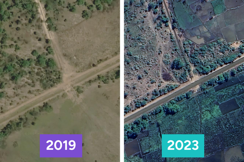
Monitor what, where and when
Verify project assets with high-resolution imagery
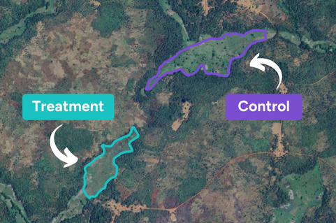
Use geospatial approaches to sample sites
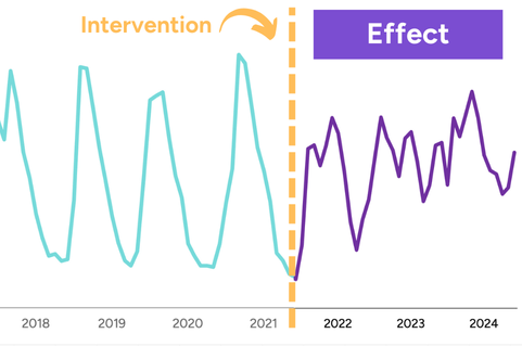
Measure effect and impact with satellite-based variables
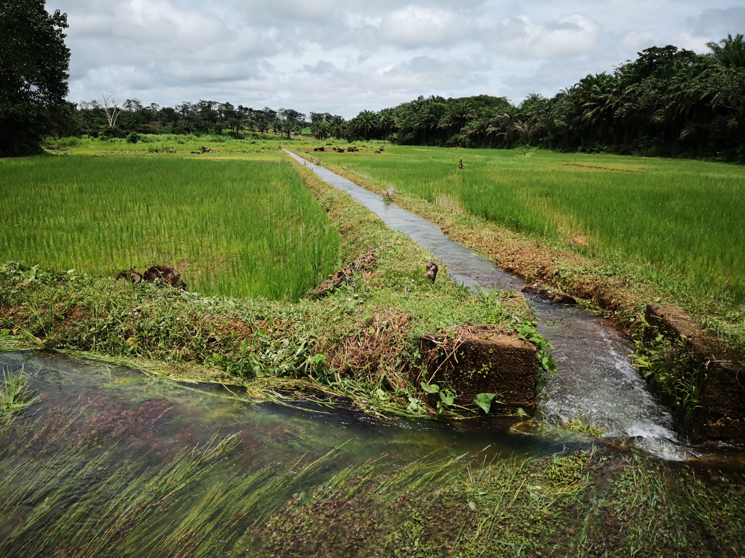
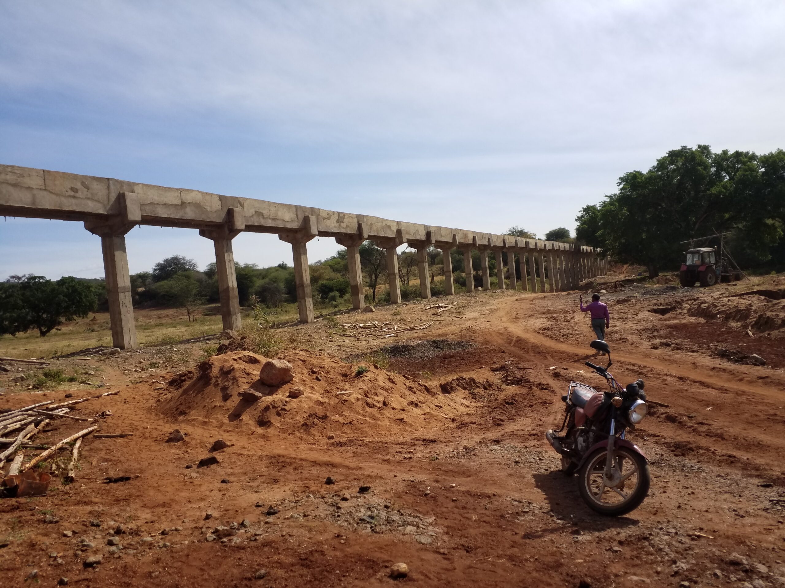
Case studies taken from real projects
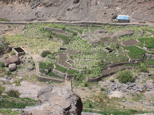
Mapping investments in Cape Verde
Geospatial sampling in Sierra Leone
Analysing schemes in Ethiopia
Oliver Mundy
Meet your instructor
“Let’s measure impact on maps”
Project designer and evaluator (geospatial focus) with 12 years of experience in international development
Reviewed GIS datasets from over 100 projects financed by the International Fund for Agricultural Development
We are looking for more case studies and expert reviewers.
Benefits for you: boost your reputation as a leading organisation in the field, foster innovation in evaluation, help to make geospatial analysis a standard practise in evaluation.
We plan to launch it in June 2025. Stay tuned. In the meantime, you can express your interest here and we will keep you updated about the launch.
We have some ideas, but we'd love your perspective on it. Fill in this form and let us know your preferred training modality and the topics you are most interested in.
This course is for monitoring and evaluation professionals with little or no experience of geospatial approaches and applications. We expect you to know the fundamentals of evaluation.